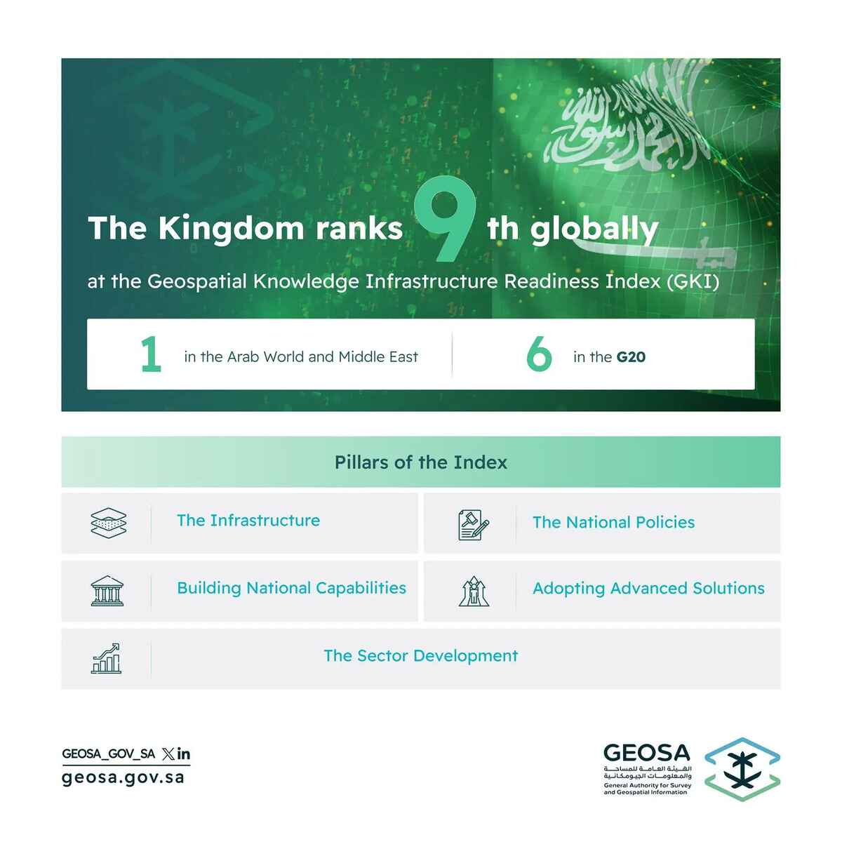
Saudi Arabia, represented by the General Authority for Survey and Geospatial Information (GEOSA), has made remarkable strides in its geospatial knowledge infrastructure readiness. It has surged from 32nd place in 2022 to 9th place in the 2025 Geospatial Knowledge Infrastructure (GKI) Readiness Index. This achievement places Saudi Arabia first in the Middle East and Arab world, and 6th among G20 nations. The announcement was made on the opening day of the Geospatial World Forum 2025, taking place in Madrid, Spain, from April 22 to 25 this year.
Assessing geospatial readiness
According to a press release from the GEOSA, the GKI Readiness Index, developed by Geospatial World, serves as a strategic framework endorsed by the United Nations Statistics Division. This index aims to assess the readiness of various countries in adopting geospatial knowledge and highlights how advancements in the index can foster economic growth, sustainable development, and digital transformation.
Saudi Arabia’s ranking across axes
The GKI Readiness Index is structured around several key axes. In the policy axis, Saudi Arabia ranked sixth globally, demonstrating its pioneering efforts in governing the national geospatial data system and formulating policies, standards, and specifications that align with international best practices. In the infrastructure axis, the Kingdom secured the seventh position globally, thanks to its essential role in consolidating national efforts related to geospatial information. This includes the development of a national geospatial platform that serves as a vital resource for the public and private sectors, academia, non-profit organizations, and individual users. Additionally, Saudi Arabia ranked eighth in the geospatial industry axis, reflecting its proactive approach in forging strategic partnerships across all sectors.
Read more: Rapid expansion of Saudi space economy to reach $31.6 billion by 2035: Report
Support from leadership
The release further emphasized that the Kingdom’s advancements in this index are a testament to the unwavering support provided to the survey and geospatial information sector by its wise leadership, including the Minister of Defense and Chairman of the GEOSA Board of Directors. This backing has propelled the Kingdom into a leading role both regionally and globally, placing it at the forefront among developed countries in the geospatial domain. Furthermore, this progress has led to Riyadh being selected as the headquarters for the United Nations Global Geospatial Ecosystem Center of Excellence, thereby establishing Saudi Arabia as a global leader in innovative geospatial information management.
GEOSA’s mandate and objectives
The GEOSA operates within its mandate to regulate the survey, geospatial information, and imaging sector in the Kingdom. This includes the adoption and development of national geospatial infrastructure, as well as the establishment of fundamental and guiding standards and controls related to the sector. Moreover, the aim is to achieve the integrated use of the geospatial information system among all stakeholders involved.