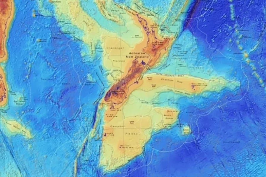
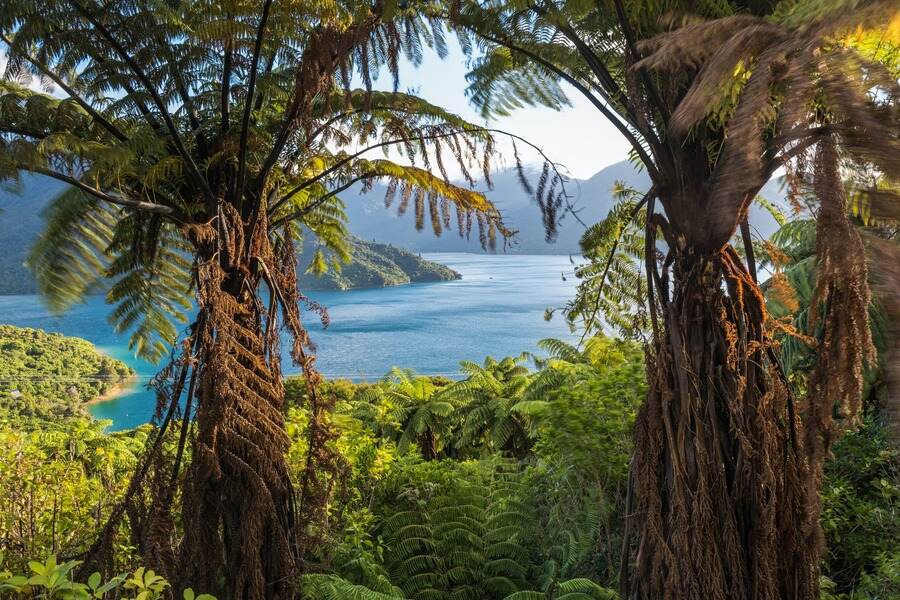
Zealandia – or the Riu-a-Māui in the Māori language – is the world’s youngest, smallest, thinnest, and most submerged continent.
The world’s eighth continent sits right underneath us.
“It’s 95 percent submerged and out of sight, it’s five million square kilometers in the southwest Pacific,” says a geologist with GNS Science, Dr. Nick Mortimer.
First evidence
The first evidence of Zealandia’s presence was in the year 1642. It was when Abel Tasman, who was a Dutch Sailor, was on a mission to discover a huge continent situated in the Southern Hemisphere.
Mortimer says the scientific story of Zealandia began in the 19th century when colonial geologists came to Aotearoa (currently New Zealand) and recognized that they were finding rocks usually only found on continents.
“Both early Māori and the European colonists identified that the two islands of New Zealand were much larger and higher and much more diverse in times of flora, fauna, geology than the Pacific Islands in the Pacific basin that they were used to.”
Read more: Egypt reveals major finds dating back to fifth, sixth dynasties
Unusual Discovery
Since the first encounter with Abel Tasman, scientists have been on the trail of Zealandia for a long time.
In 2017, a group of geologists hit the headlines when they announced their discovery of Zealandia. A vast continent of 1.89 million sq miles (4.9 million sq km) it is around six times the size of Madagascar.
The total area of Zealandia is about 4.9 million sq kilometers. This is nearly 6 times the actual size and area of Madagascar. Apart from New Zealand, the are other areas and islands encompassed by the continent, such as New Caledonia and other Australian territories belonging to the Lord How Island, as well as Bali’s Pyramid.
There is no doubt that Zealandia will continue to surprise researchers as they examine and analyze it. This will provide them with significant scientific insights. The finding serves as a reminder of just how much more there is to learn about our planet and uncover.

Lemuria
In the 19th century, a rumor circulated in the scientific world that a “lost continent” was laying undiscovered at the bottom of the Indian Ocean. They named it Lemuria as their misguided efforts were driven by some very confusing lemurs.
The idea is largely credited to British zoologist Philip Lutley Sclater who wrote a paper titled “The Mammals of Madagascar” in 1864, published in the Quarterly Journal of Science. Sclater explained that lemur fossils could be found in Madagascar and India, but not in Africa or the Middle East, suggesting that Madagascar and India were once been part of a larger continent that’s since gone missing in the Indian Ocean.
The theory gained a bit of traction in the 19th century because this was long before the discovery of plate tectonics and “continental drift”, which explained how the world’s continents are constantly (and very slowly) drifting around the planet.
It turned out, the theory that India and Africa were once joined was true. Until around 200 million years ago, all of Earth’s continents were once smooshed together in one supercontinent, Pangaea. In this configuration, the Indian Plate was tucked up close to the east of the Africa plate.
Furthermore, there was genuinely a microcontinent called Mauritia that was located between India and Madagascar until their separation about 70 million years ago.
In 2017, scientists confirmed the existence of the “lost continent” by finding evidence of a piece of continental crust under the island of Mauritius in the Indian Ocean. Their work indicated that this chip of ancient continent likely broke off from the island of Madagascar, when Africa, India, Australia, and Antarctica split up.
For more on the latest finds, click here.


